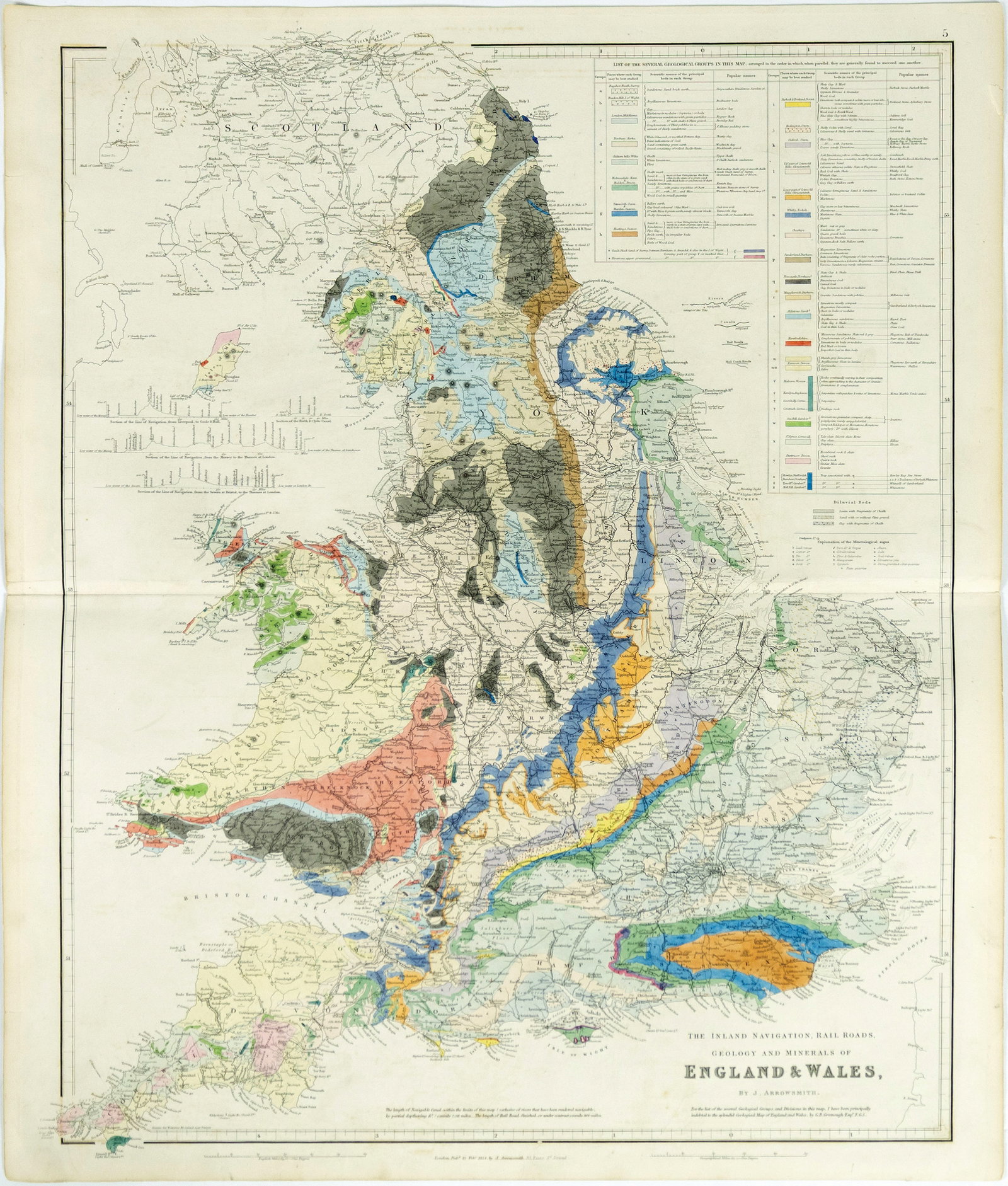
Arrowsmith's geological map of England and Wales - One of the Earliest of 19th Century England
Updated September 3, 2026
| Lot number | 0142 |
| Estimate | $1,000 - $2,000 |
| Opening bid | $600 |
| Auction | Arader Galleries October 3, 2026 Auction |
| Date | October 3, 2026 at 1:00 PM EDT |
| Auction house | Arader Galleries |
| Location | New York, New York |
ARROWSMITH, John, (1790-1873). The Inland Navigation, Rail Roads, Geology and Minerals of England and Wales. Engraved map with original hand color. London: Arrowsmith, 1834. 25 1/2" x 21 3/4" sheet.
Register & bid on this lot at Bidspirit →
More lots in this auction
- Collins engraved map of A New and Correct Chart of the Channel between England & France
- Rocque Wall Map of Ireland, 1770
- Valck engraved map of La Mer Mediterranee
- Bird's Eye View of Plymouth, Devon England
- Bunting Woodcut Map of the Ancient Christian World, Apostle Paul
- Dayes Engraving of Oxford showing A View of the Theatre, Printing House
- An extremely rare Lafreri School map of France originally by the Great French Mathematician Oronce
- De Bry's Famous Map of the Rhine River in its first state